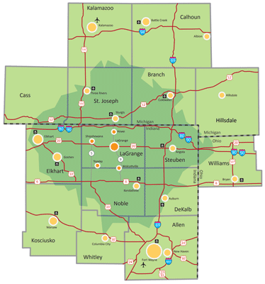
LaGrange County offers easily accessible solutions for transportation of goods in every direction.
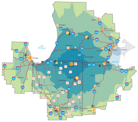
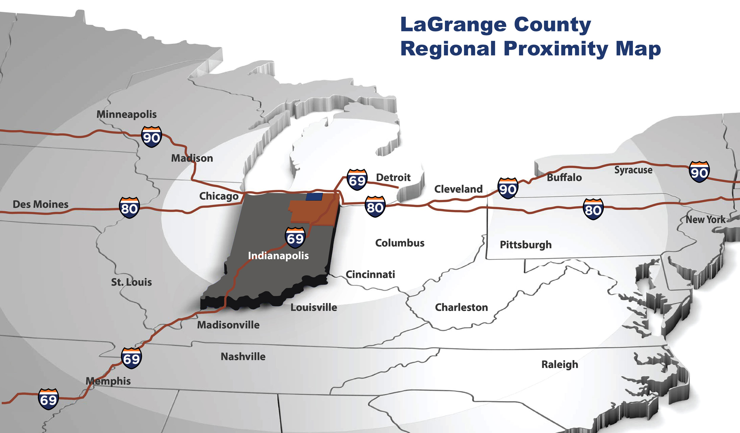
Did you know that 75% of the U.S. and Canadian populations are within a single day’s drive of the state of Indiana? Or that the state of Indiana has more pass-through Interstates than any other state in the nation? LaGrange County boasts interstate access via I-80/90, the 157-mile-long toll road stretching from Illinois to Ohio, as just one of our many proximal assets. Running right through the center of the county, and only seven miles south of I-80/90 exit 121 for Howe/LaGrange is U.S. Highway 20 – a coast-to-coast route. There are also four state roads (3, 5, 9 and 120) that pass through LaGrange County. Short line rail access is available in the southern portion of the county, with accessibility to main line railways around 20 miles south of the county’s center. We are within a few hours of five major metropolitan areas – Chicago, Cleveland, Indianapolis, Cincinnati, and Detroit, three of which are ranked in the top ten list of largest cargo airports in the country. Burns Harbor, Port of Indiana provides year-round waterborne shipping access and is within 110 miles of LaGrange County, and the Ports of Cincinnati and Northern Kentucky are within 250 and 300 miles respectively.

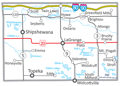
State Roads
Indiana State Roads 3, 5, 9, and 120 all pass through scenic Lagrange County.
US Highway 20
US Highway 20 is only seven miles from the Howe-LaGrange interchange to the 80/90 Indiana Toll Road, and US 20 is a coast-to-coast route.
I-80/90 Indiana Toll Road
LaGrange is located off exit 121 of the toll road, which is 157 miles long and runs from the Illinois state line to the Ohio state line.
Metropolitan Areas
Chicago, Cleveland, Indianapolis, Detroit, and other metropolitan areas are within a few hours’ drive from LaGrange County.
Aquatic Ports
Three aquatic ports located on the Ohio River and Lake Michigan are easily accessible from LaGrange County.
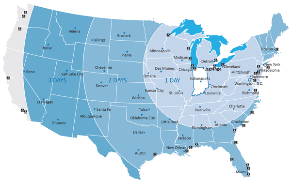
Driving distances to various metropolitan areas radii of one-, two-, or three-day driving distances.


How Does LCEDC Serve LaGrange County?
The LCEDC’s involvement was a key factor in why we chose to relocate our business from Michigan to LaGrange.
– Brian Miller – Lake Area Designs, EDC Board Member